
|
Today I wanted to head to Island Peak base camp and meet the Spanish group one last time before they headed up the mountain. Irene was a bit tired so she decided to join only up to Chukhung. We left at 8:00 and enjoyed the clear morning.
|

|
It had been quite cold during the night and the stream we hiked along had deposited ice on plants and rocks.
|

|
At Bibre we took a 20 minute break for some food and pictures. At 9:40 we arrived in Chukhung and had some honey toast. Irene slowly made her way back down to Dingobche from there taking lots of pictures.
|

|
Bhim and I continued on at 10:20 heading up on a moraine with a great view of Amai Dablam.
|

|
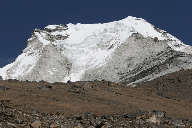
Chukhung glacier is a bit east of Amai Dablam on a northwest facing wall.
|

|
After a while the trail drops off the side moraine into a nearly flat valley. It eventually reaches a small stream and runs parallel to it.
|

|
Just before the end of the Imja glacier the path turns north to get on the northern side of the glacier. Lhotse is in the background and Island peak is on the right. After a few hundred meters the trail heads east again between Island peak on the left and Imja glacier with its lake on the right.
|

|
We arrived at the base camp at 12:15 and found the Spanish group which had overnighted in Chukhung setting up their tents. They would go to bed early and head up to Island peak very early the next morning.
|

|
From base camp it was just a short steep stroll up the moraine until we could see Imja Tso, a huge lake that has formed on the Imja glacier. My old 1999 edition Schneider map only shows several small lakes scattered across the glacier but in the past years these lakes merged into one. Scientists are quite concerned that it will eventually breach the terminal moraine and lead to a devastating flash flood threatening Chukhung and Dingboche.
|

|
Another shot of base camp. It was quite busy, probably at least 50 tents.
|
|
We headed back down at 12:45 and passed a group of swiss trekkers. We later saw them again in our lodge, they belonged to the group we had met the day before.
The image on the left shows island peak from the south.
|
|
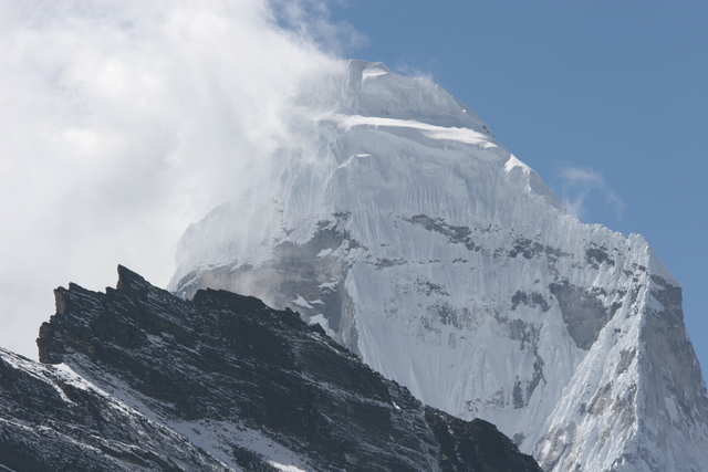
Amai Dablam trailing clouds.
|

|
I was unable to find the name of this beatiful pyramid.
|

|
Mani stones on the way back.
Since it was our last day at high altitude and I was only carrying about 8 kilos, I started to walk down at full speed. We reached Chukhung in 1:20 and then it only took me 45 minutes to get back to Dingboche. Great fun, but I was quite exhausted when I arrived. Bhim decided to take it easy half way and arrived 15 minutes later than me. Irene was lounging in the sun and quite surprised to see me back so early. I ate two dishes for lunch and went for a nap.
|
|
Previous Day
|
|
Next Day
|