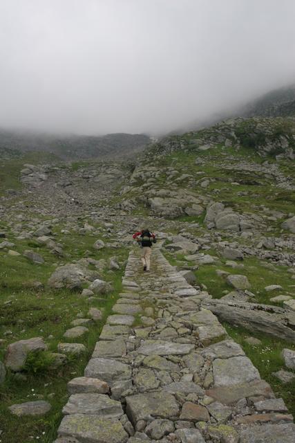
In Macugnaga we did some shopping for a picnic lunch. The clouds did not disappear but it was not raining so we set out for Colle del Turlo. The sign in Macugnaga suggested a total hike time of 5:45. The path first descends the Anza valley for a bit but soon begins to climb gradually and turns south into the side valley leading up to the pass. After about one hour we reached the Lago delle Fate, an artificial lake that was partially blue and partially brown due to recent rainfalls. There were two nice looking restaurants on the lake but it was still too early for lunch so we continued on. The trail remained moderately steep and it we made quick progress. At an altitude of about 1560 meters, the creek splits up into several small steep streams and the trail starts to climb in earnest. It leads across Alpe La Piana and heads into the forest. The trail is quite exceptional, it is surfaced with natural stones of varying sizes and about 1,5 to 2 meters wide. Walking up hill on it was quite efficient. Around 13:00 we took our lunch break and enjoyed some excellent cheese from the Rifugio G. Oberto which had been leftover the previous night.
We passed some stone ruins on Alpe Schena at 2037 meters and soon reached the Lanti bivouac. Since it was still only about 14:00, we decided to try to at least cross the Colle del Turlo before nightfall. Since we were carrying a tent, mats and sleeping bags, we could have camped out anytime so the clouds did not deter us.


We were pleasantly surprised by this night's lodging. Rifugio Pastore is at an altitude of only 1575 meters and quite accessible, so there were hot showers. It was quite full so we only got beds in the shared quarters, however, they were very nice and it was not completely occupied. Dinner was again very good, this time the polenta with ham and the chicken were the most delicious items for me. I bought a more detailed map of the south side of Monte Rosa to better plan the next days. The solo hiker we had met the previous night arrived a bit after us, she had left before us but did not use the cable-way bringing her to a total of about 12 hours of hiking! We also made the acquaintance of a former mountain guide from Ireland who was doing the TMR in the opposite direction. He had some interesting stories to tell and some of his gear was self-made.